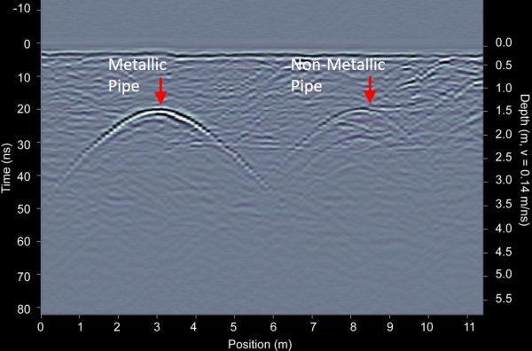
Ground penetrating radar (GPR) is an electromagnetic method used for very near surface applications; metres through 10s of metres. It is sometimes referred to as echo-sounding. GPR exploits contrasts in electromagnetic properties (dielectric permittivity, electrical conductivity and magnetic permeability) in order to define the physical boundaries of shallow structures (both natural and man-made). GPR is ideal for near-surface applications because it provides higher resolution images than methods such as FDEM, TDEM and magnetotellurics.
We specializes in the acquisition, processing and interpretation of potential field datasets, with particular emphasis on gravity & electromagnetics. Strategically, with partnering global airborne geophysical company we expand into other geophysical acquisition markets that encompass methods such as electrical, electromagnetic, induced polarization and reflection seismic. We offer our clients a complete airborne (aircraft/UAV) and ground (Cart) geophysical solution.
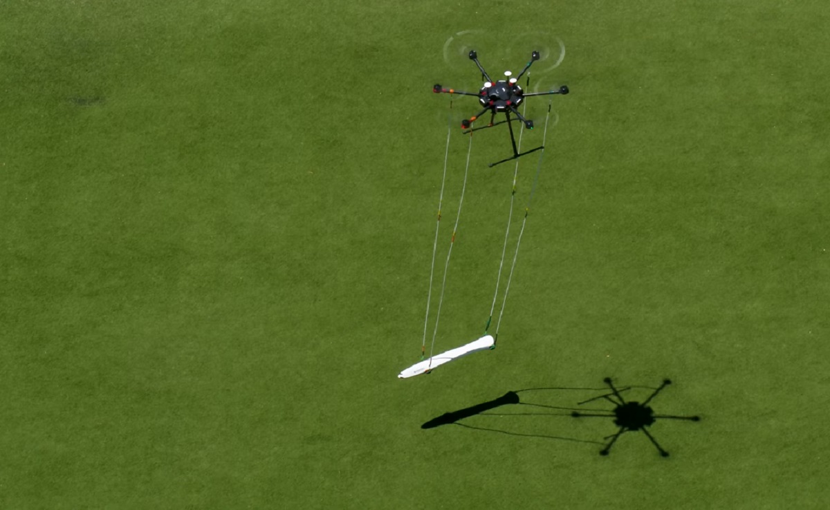
UAV Electromagnetic Survey
Aeromagnetic survey with UAV for mineral exploration & underground object detection has become ubiquitous. They can fly at a lower speed, lower altitude, and are cost-effective compared to traditional manned aeromagnetic. Both the technologies continuously upgrading.
Our first ever UAS-enabled magnetometer produce ultra-high resolution and ultra-high quality airborne magnetic survey data, quickly and safely. We measure strength of the magnetic field near to the earth’s surface and the measurements are then plotted in their relative positions and contoured in an image the patterns of measured low and high magnetic field strength in the image will reflect the position, shape and size, and magnetic properties of the rock bodies and structures within the earth’s crust. We can perform a precise aeromagnetic survey at extremely low altitudes in any terrain conditions
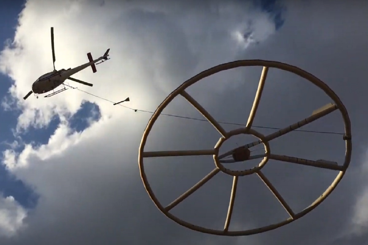
Airborne Geophysics
Airborne geophysical imagery provides a continuous view of the surface and subsurface geology down to a depth of several hundred metres. Depending on the sensors carried by an aircraft or helicopter, several characteristics of the subsurface can be investigated rapidly despite forest cover or difficult terrain. This tool is a valuable decision-making aid when prospecting for raw materials, from regional targeting to the characterisation of deposits. Airborne geophysical sensing cross-referenced with the study of available drilling data, and supplemented by targeted geological field checks, provides 3D imaging of the information being exploited and/or of interest, quickly and at a lower cost. Alterations in mineralogy, moisture content, stratigraphy, porosity and salinity have the potential to be detected by airborne electromagnetic (EM) surveys and can be represented in three dimensional images. Airborne magnetic surveys map variations due primarily to the magnetite content of rock.
Utility Location and Mapping
Through our GPR Survey we detect and accurately record the position, depth, route and type of buried services and utilities detection using Ground Penetrating Radar (GPR), Radio Frequency Detection (EML), Cover Lifting & Topographical Survey Techniques. This comprises Water, Power, Gas, Telecommunications, Fibre Optics, Drainage and other Sub-surface features including Sub Surface imaging.
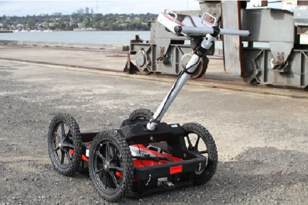
Survey works can be completed using cart-based or vehicle mounted GPR Systems, depending on the site characteristics and depending on the methodology required for that particular site.
Underground Detection
Ground Penetrating Radar (GPR) Units equipped with a 400 MHz antenna and a powerful datalogger/software package that detects and maps utility pipes, shallow engineering structures, and performs numerous environmental applications. we utilise the latest Ground Penetrating Radar technology and Electromagnetic tools. This allows us to locate cables, pipes and all utilities; gathering subsurface data through images without destroying the surroundings.
- Pipeline Detection
- Object Identification
- Soil Compostion
- Slab thickness/concrete cover
- Archeological investigations
- Bridge condition assessments